Arctic cold from polar vortex to hit US with triple impact until mid-December
- Last update: 1 days ago
- 3 min read
- 973 Views
- WORLD

A significant surge of Arctic air is set to descend from the North Pole into central and eastern parts of the United States, as the polar vortex positions itself near Hudson Bay, Canada. This pattern will bring repeated rounds of frigid temperatures and snow showers through the middle of December.
The initial wave of Arctic air is expected to produce subzero readings from the Dakotas and Minnesota down through Iowa and Nebraska, while the rest of the Central and Northeastern states may see the coldest temperatures of the season so far. Meteorologists are predicting that this will be the first of three major cold events in the coming weeks.
The current outbreak is due to a shift in the polar vortex, said a leading long-range weather forecaster. Following this week, we anticipate another cold surge next week, with a third one arriving the week after. These Arctic air intrusions will likely drive higher energy demands as residents heat their homes.
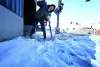
Early Thursday mornings have already seen temperatures fall into the single digits, teens, and twenties across the central and southern Plains, the Ohio Valley, and parts of the inland Northeast. As the cold air moves east, readings along the Interstate 95 corridor are expected to drop to similar levels later this week, necessitating full winter attire for many.
Ski resorts that have not yet received natural snowfall are ramping up snowmaking efforts to prepare for the season. In regions with high winds, RealFeel temperatures could feel 10-25F colder than the actual thermometer readings. Some daily low-temperature records may be challenged during this period.
Although warmer patches and clouds may prevent the Southeast, particularly Florida, from seeing extreme lows until next week, interior areas of the Southeastern states still face the risk of hard freezes. Residents are advised to complete winter preparations for their homes, heating systems, and water lines.
As the Arctic front advances, scattered snow, flurries, and snow squalls are expected across the Great Lakes and northern Appalachian regions. The first Arctic front will sweep through from the Great Lakes to the Northeast between late Wednesday and Thursday, with the possibility of brief snow showers reaching the Interstate 95 corridor. These could create slippery conditions, while lake-effect snow could accumulate a few inches in localized areas.
Further cold-air events through mid-December may generate longer-lasting and heavier snow in some regions. The western edge of the Arctic air will contribute to a southward-moving snowstorm over the Rockies, impacting Wyoming, Colorado, and northern New Mexico into Thursday. How the cold air interacts with a storm in the southern U.S. will influence whether snow, ice, and rain mix or if rain dominates in the eastern states from Thursday night into Friday evening.
Travelers should anticipate possible disruptions on highways and at airports, and schools may implement delays, early dismissals, or closures as needed.
Author: Gavin Porter
Share

Arctic cold from polar vortex to hit US with triple impact until mid-December
1 days ago 3 min read WORLD
Get ready for a third round of the Polar vortex
1 days ago 1 min read ENTERTAINMENT
Expert warns of upcoming extreme cold in US region: 'Temperatures dropping sooner than ever'
1 days ago 3 min read WORLD

Weather Terminology: Unexpected Stratospheric Heating
2 days ago 1 min read ENTERTAINMENT
Possible weekend snow in eastern US following first of three polar vortex episodes.
2 days ago 3 min read WORLD

December Weather Predictions Across the US by The Old Farmer's Almanac
2 days ago 3 min read WORLD

Millions in the Midwest, Northeast to Experience Record Cold During First Week of Meteorological Winter
3 days ago 3 min read WEATHER

New Jersey declares state of emergency in anticipation of first major winter storm of the season
3 days ago 2 min read USA

Northeast getting ready for the first significant snowstorm of the season
3 days ago 3 min read WEATHER.

Major impacts from heavy snow and ice across the nation as powerful coast-to-coast storm begins December
3 days ago 2 min read USA